Swansea Marina

Vibrant City by the Sea

  • Facebook
  • Flickr
  • Twitter
  • Weather
  • Quotations
    • 20% discounted annual berths
    • 28 day visitor bundle
    • Berth holder benefits
    • Contact us
  • Tides and locks
  • Berths
    • Pontoon map
    • Handbook
    • Pay an invoice
    • Report a fault
    • Contact us
  • Navigation
    • Pilotage
    • Low water river
    • Lock operation
    • Traffic lights
    • Contact us
  • Visitors
    • Book a berth
    • 28 day visitor bundle
    • Handbook
    • Contact us
  • Latest news
You are here: Home / Berths / Pontoon map

Pontoon map

The Marina is split into three phases.

Phase One is closest to the River Tawe and is accessed through the Marina Lock. Phase Two is beyond phase one through the swing bridge. It’s in the area of the National Waterfront Museum and the Swansea Museum boats. Phase Three is the furthest from the Marina Lock and is closest to the Meridian Tower.

You can view plans of each phase below.  Click on the image for a larger view.

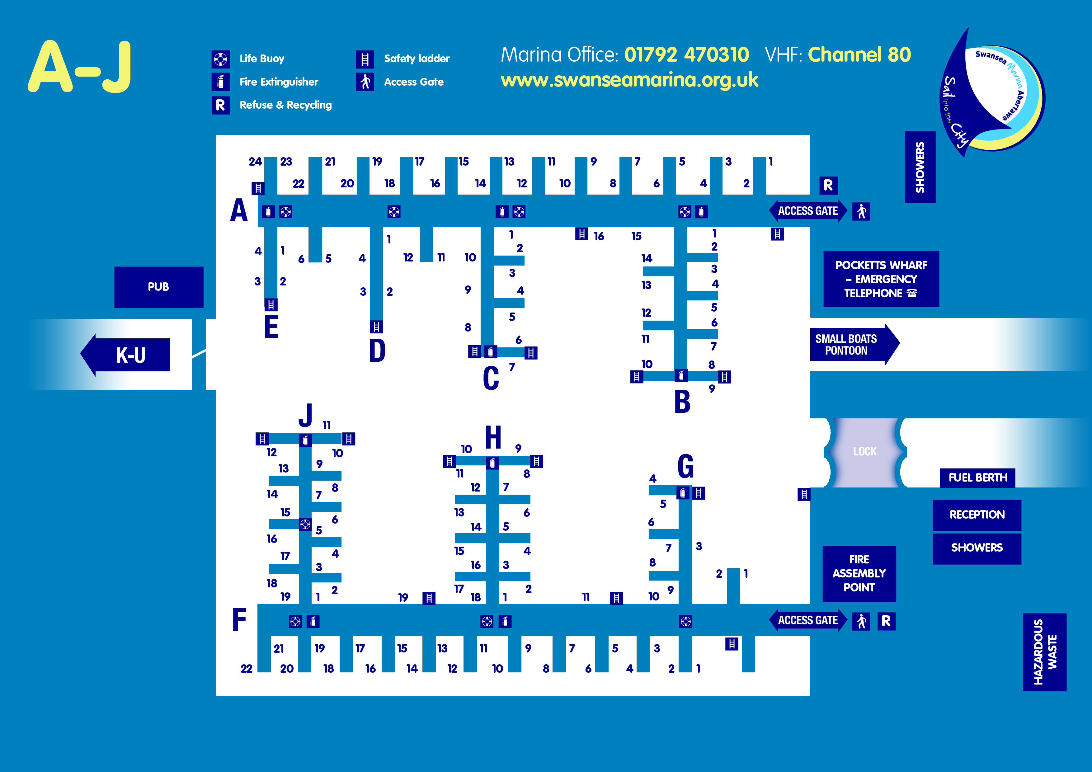
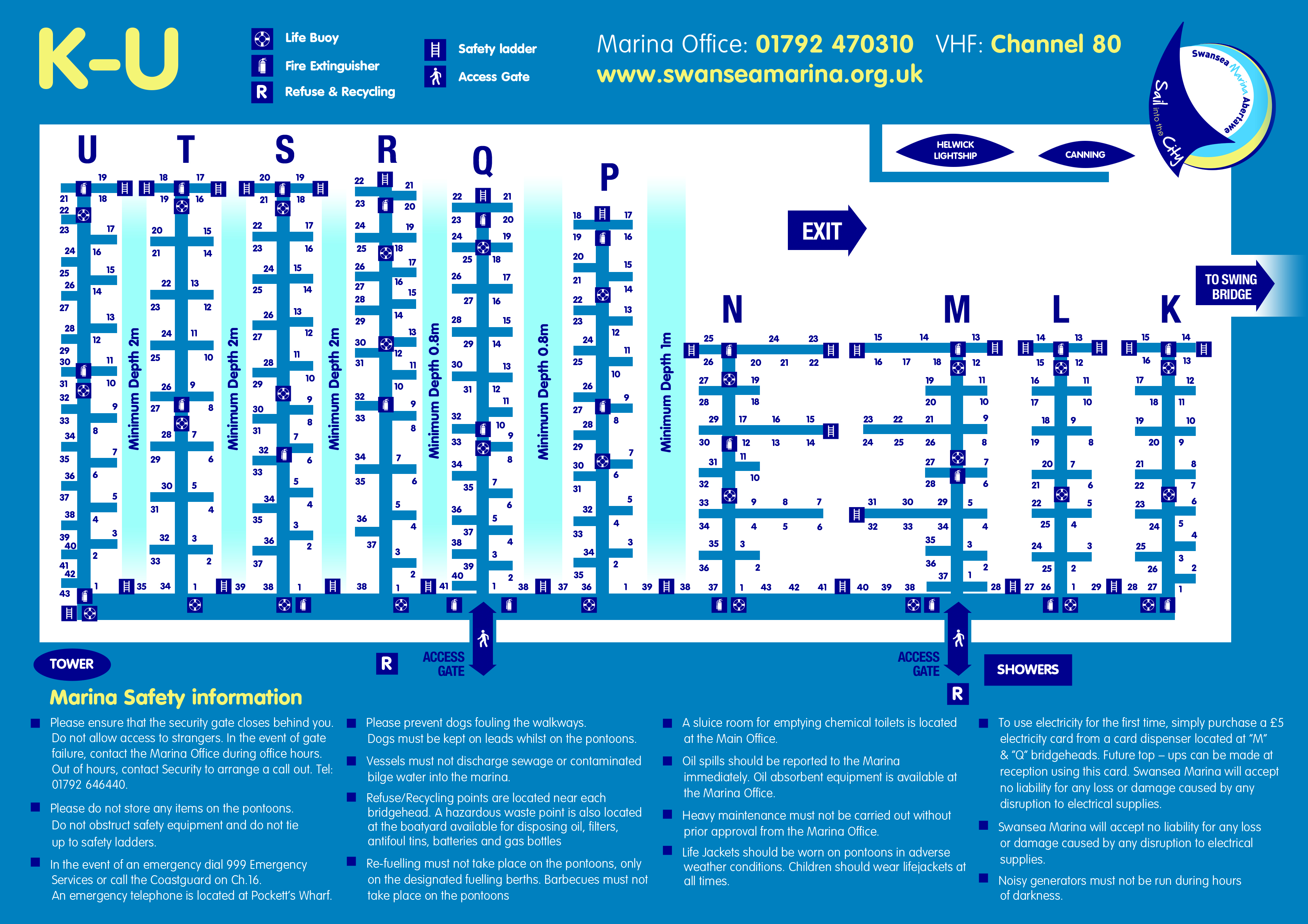
If you prefer you can download a pdf version of the Plan of Swansea Marina (pontoons A-J and K-U).

Swansea Marina, Lockside, Maritime Quarter, Swansea, SA1 1WG
Telephone : 01792 470310 Email : swanmar@swansea.gov.uk
Out of Hours Security : 01792 646440
VHF Channel 80
Waypoint position : 51° 36′.40N 03° 55′.60W

Marina Abertawe, Ochr y Loc, Ardal Forol, Abertawe, SA1 1WG
Rhif ffôn : 01792 470310 Ebost : swanmar@swansea.gov.uk
Diogelwch y Tu Allan i Oriau : 01792 646440
VHF Channel 80
Waypoint position : 51° 36′.40N 03° 55′.60W

Return to top of page

Copyright © 2025 · Swansea Marina | Privacy and cookies